My First bRamble (route)
by Devin McKinney
Do you remember the first time you rode the Blackberry bRamble? I do, like it was yesterday. It was actually last week, but close enough. And yeah, it wasn’t the formal ride event that is coming up on August 9th, but I did ride the 100 mile route so it kind of counts.
Full disclosure – before this, I’d never ridden 100 miles in one day – I did 75 a few weeks ago riding to Brownsville, and I rode up to McKenzie Pass the weekend before, so I figured I could handle it. Anyway, my impressions probably wouldn’t match someone with more experience – we all know that first time through effect, those are often the hardest rides. If you’ve never ridden a century, or never ridden this one, maybe you’ll even find some inspiration in my story and sign up for this year’s ride!
First, let me just say that this was a fantastic ride, with distinct sections each with its own personality and memorable views and terrain. I had ridden the metric century before, but had never seen Siuslaw River Road or Wolf Creek. I thought I’d give my impressions section by section, with a picture or two because, well, view-tacular.
Fox Hollow Ascent
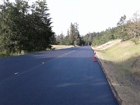
Anyone who rides in Eugene has gone up Fox Hollow at least once, so nothing new there. Wait, there is something, they’re just finishing repaving it! I was actually the first bicycle through on the day they finished, and had to wait 10 minutes chatting with the road building professional halfway up (what do they call them?). She had worked on the shoulders and approaches for the Crow pave project, and I told her that the bicyclists of the region all appreciated her work. She liked that. The chase truck finally came down and led us up Fox Hollow – there were ten cars behind me, a funny caravan to start out my first century ride. The funniest line of the ride was when the driver looked at me and asked “So how fast do you want to go?” Like, I’m on a bike, dude, going uphill, how fast do you think??? It was one lane all the way up, so I was able to keep my pole position until the end of the new pavement towards the top. No delays like this for the Blackberry bRamble in August, I’m sure – just smooth fresh blacktop making the first ascent go by in no time.
McBeth Descent
Short snappy descent down Macbeth, what a beautiful vista. I had a feeling I would be riding across the horizon I could see, from left to right, south to north, farther than the farthest hill I could see in the distance. Cool.
Lorane Highway
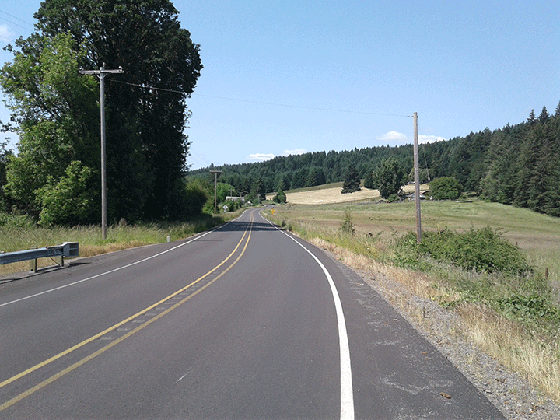
I knew the part of Lorane Highway near Eugene pretty well, but had only been farther south once or twice. It definitely feels more rural as you get closer to Lorane, maybe because there are fewer people that live farther out. I love long lazy roads like this where you can see the road stretching out ahead of you for miles. For the formal ride there is a rest stop in Lorane – I stopped at the general store at the end of town and bought a chocolate chip cookie.
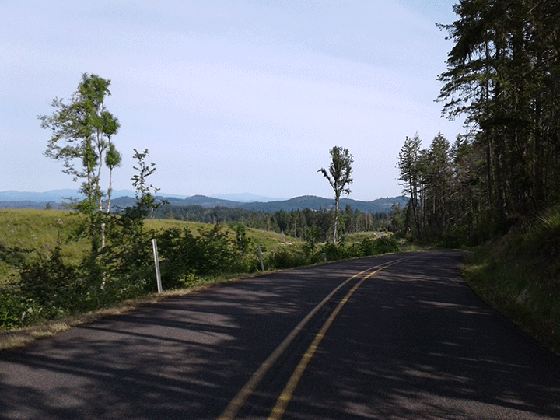
Siuslaw River Road
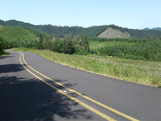
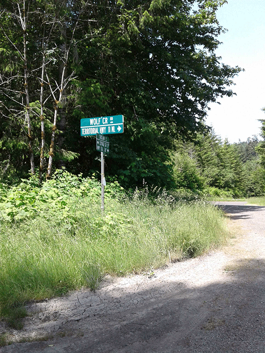
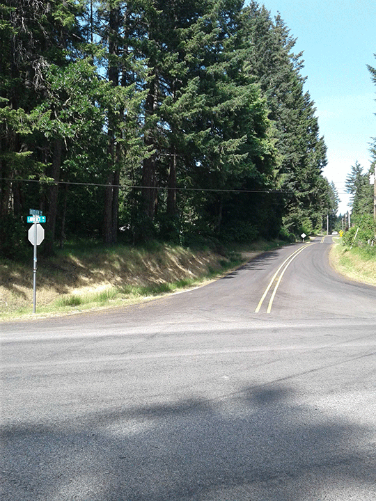
I’ll be honest, since I arrived in Eugene a year ago Wolf Creek was presented as the “big bad wolf” of local rides. I was both eager to see it, and dreading it as well. Not much to dread here on Siuslaw River Road – miles and miles of shaded road, mixed with long flat ridge riding along cleared hilltops that paralleled the river going west. So many great things about this lengthy stretch of heaven – the quiet, the lack of traffic, the way the road winds along through secret forests and you expect to see hobbits peering out at you on some of the turns. Toward the end of Siuslaw the road started following the folds of the ridge to the north, which mean some steep descents followed by equally steep ascents. At one point I considered complaining to the people who built the road about having to climb what felt like the same hill THREE TIMES, but I got over it. I finally arrived at the Wolf Creek turn with what turned out to be a very straightforward ascent to follow.
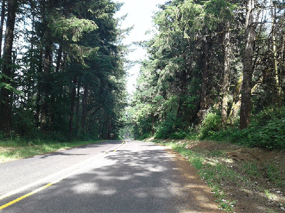
Wolf Creek ascent and descent. Oh, and descent
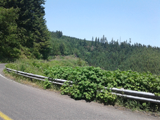
My trick with ascents is to watch the skyline – if I can see blue through the trees, then that has to be at least a top if not the top, because who would build a road that didn’t cross at the lowest point of a ridge? Wolf Creek was actually easy by that standard, with no false tops – just a few miles of up, nothing too steep, all of it with spectacular views to the east toward Cottage Grove. The descent on the other was quick and easy through a series of shaded turns. I was surprised here by a “false bottom” – when you get to the bottom of the hill, you then ride for about five miles through farmland, and then there is ANOTHER descent, pretty sharp, that takes you down off of what I’d call the Wolf Creek plateau. The second descent was a nice surprise, and minutes later I was riding up the short hill into Crow. I guess there’s a rest stop here on the real bRamble – I just parked it on the bench in front of the now-defunct general store and had lunch.
Crow to Noti
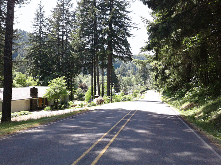
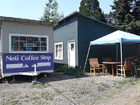
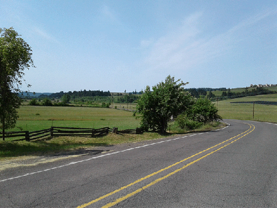
I’ve ridden Vaughn Road a few times now, and it is always a delight, a series of straightaways and long curves and smooth road through what look like a series of small logging communities. It feels like one long descent although I know there are some gradual slopes up, anyway you hardly notice them. An easy ten miles in the middle of the century, bringing you in to the small town of Noti. There’s a new business in Noti, the Noti Coffee Shop, with some really nice people serving delicious espresso drinks. They are excited to support the bRamble ride and plan to stock up with the right stuff. They asked me what the right stuff was, and I showed them what I was carrying for the back half of the ride: 1/2 PB&J sandwich, 2 bars, water, gatorade, half a cookie, apple slices. I had a double macchiatto and sat in the shade for a few minutes. I expect this unofficial rest stop will be a huge hit on the day of.
I always look for what I call the “heart” of a long ride, once you’re warmed up and get in the “zone”. It’s usually the middle part of a ride, along some scenic stretch that the ride planners thought was worth riding, and when you are in it you feel like you could just keep going forever. For me, Fox Hollow and Lorane were kind of the warmup for this ride. The heart of the Blackberry bRamble, from the town of Lorane to the end of Poodle Creek, is huge, a whopping 50+ miles of rolling hills and woods, with an ascent or three in the middle.
Poodle Creek
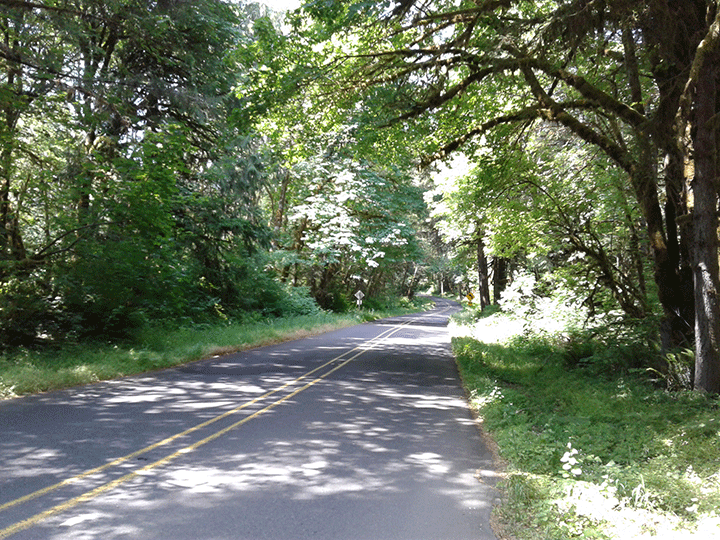
I somehow expected to see more poodles here. Or creeks named after a poodle. Or at least dogs. A quick Google Maps search shows that the river you ride along is called the Long Tom River. I’m sure there is a story in why this is not called Long Tom Road. Anyway, Poodle Creek starts out as a yet another wide open ride through rolling hills and farmland, then shifts to a more wooded narrow ride along the Poodle Creek Long Tom River as you approach the Mapleton-Junction City Highway 36 which will take you to the final hills and trees section of the ride on Lawrence/Butler. It’s all great, although definitely watch the traffic toward the end where there are some steep drops to the right, logging trucks can come by pretty fast.
Lawrence/Butler/Fern Ridge Lake
I believe there is a rest stop when you turn off Highway 36 at Lawrence for the formal ride which is a great place to prep for the final push to get to Fern Ridge Lake. I ate a bar and pretended to chat with the other bicyclists. Surprisingly, my times were much better than theirs! Lawrence to Butler is one of your final ascents, not long, not steep, then Butler. Ah, Butler. Butler is a good test for whether I’m in shape. It starts steep, but is very short, and if you just jump on it you can easily get past it to the descent. Like swallowing some medicine, you know it’s good for you but you are glad to put it behind you. I made sure everything was tucked in tight in my back pockets because I knew I’d be pushing on the short, fast descent down Butler.
Rode along Kirk Road and savored my final windy tree-lined road, finally emerging next to Fern Ridge Lake.
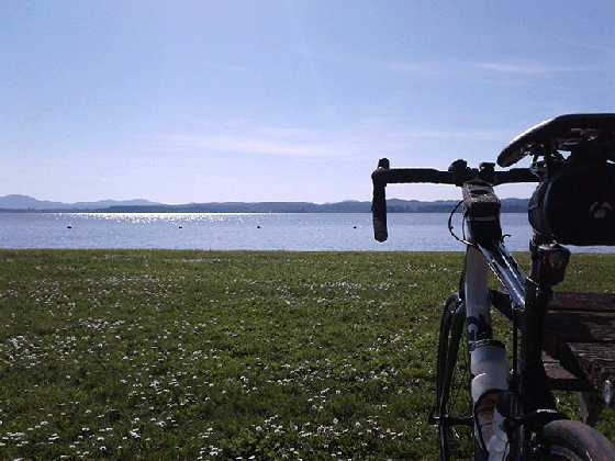
I stopped at the lake and had my final bit of food. Another horizon – it turns out that I actually did ride completely around all the hills I could see in the distance. Cool.
Back to Eugene
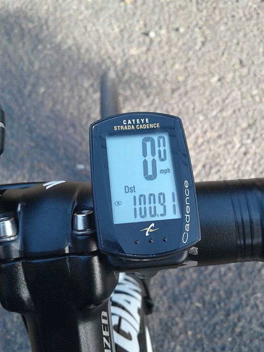
Not much to say about the final part except I had a fantastic tailwind (is that redundant, does anyone not love a good tailwind while they’re riding?) down Clear Lake – it felt like I was being carried along on the wings of the angels. Once I got in to Eugene, via the wind-swept wetlands of the Fern Ridge Bike Path, I rode past my house to the actual end point of the bRamble, to make sure Strava and my Cateye ticked over 100 miles. No balloon arch but I definitely heard some cheering (in my head at least).
So. My first century, done. How did I feel afterwards? Great – it wasn’t that different from a 75 mile ride, just a little longer. I can’t compare it with others (yet!) but I had a fantastic ride and the last twenty miles were easier than I expected. I could have gone another 10 or 20 probably, if it were flat. Or even slightly downhill. With a tailwind. OK, the reality was I was kind of done in by the end, but give me a couple days and I could for sure do another 100.
So I have a riding bucket list that I set up four years ago, with my century ride as the final one. To get to that I had six other milestones that I had to do first – 10/20/30/40/50/75 miles. I checked off 75 miles last September riding up to Brownsville, and this ride let me finally check off my last item for 100 miles. Someone told me it’s time for a new riding bucket list, so I’m taking suggestions. For sure there will be a few more centuries on it, probably with some of my friends from GEARs!